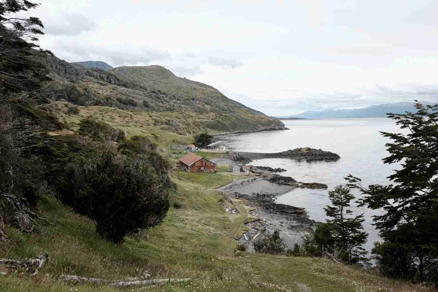
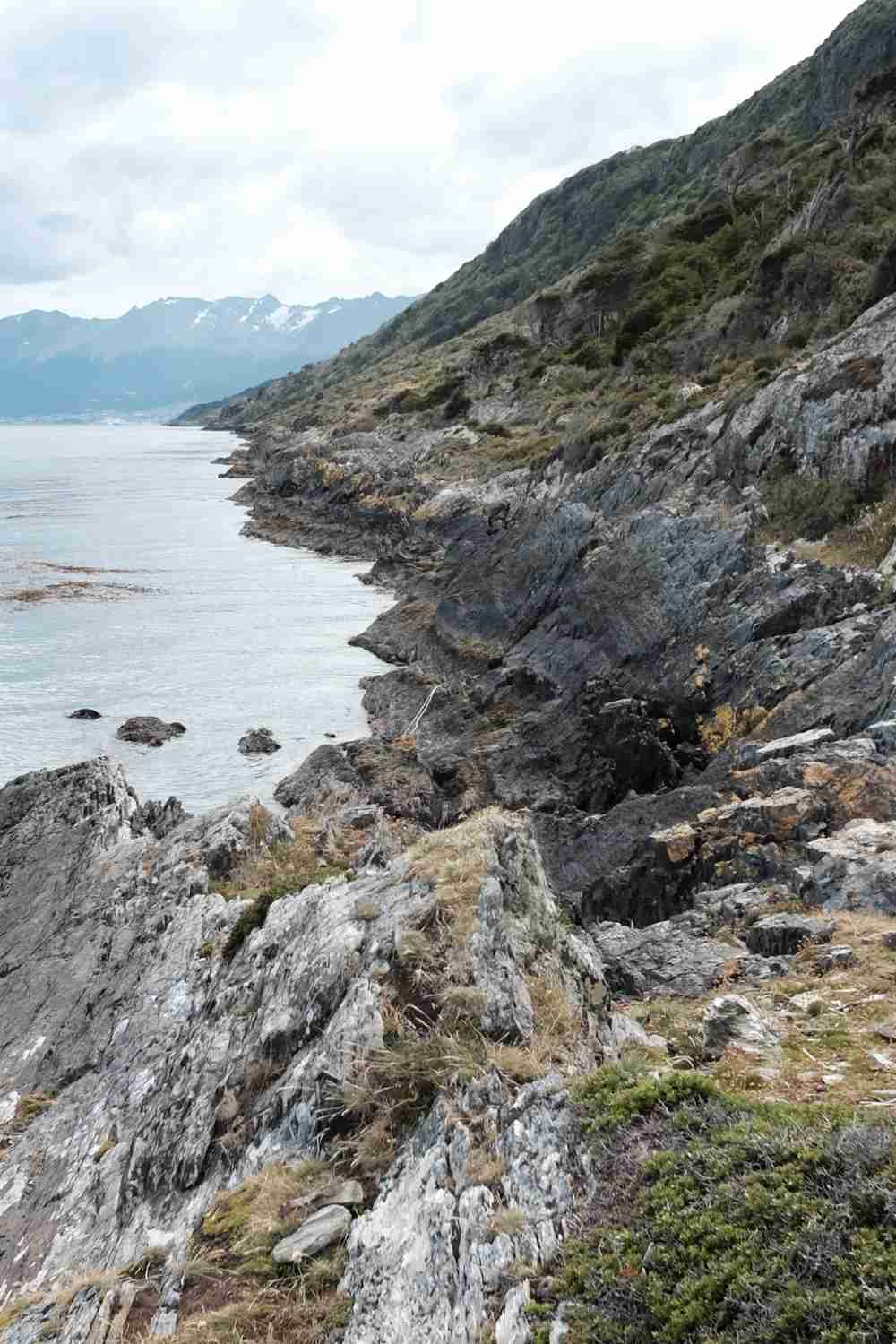
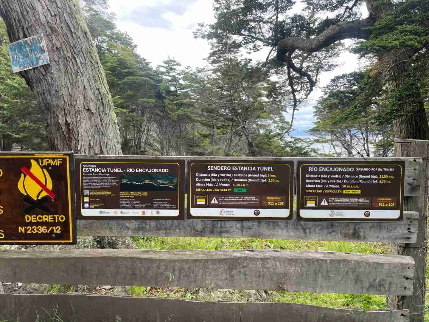
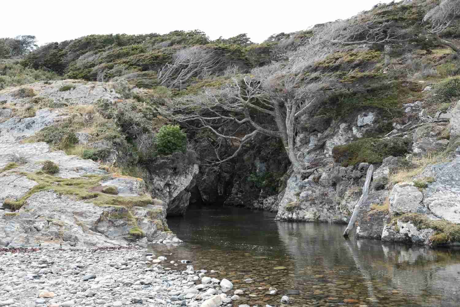
1️⃣ Playa Larga-Mirador San Sebastian-Estancia Tunel- Rio Encajonado (p1-7, 20km)
▫️ Begin your adventure by catching the bus. The starting and return point for this hike can be easily located on maps.me by searching for “parada 470”. The first bus departs at 6:45 AM, and the last one runs after 11 PM, giving you plenty of time to explore.
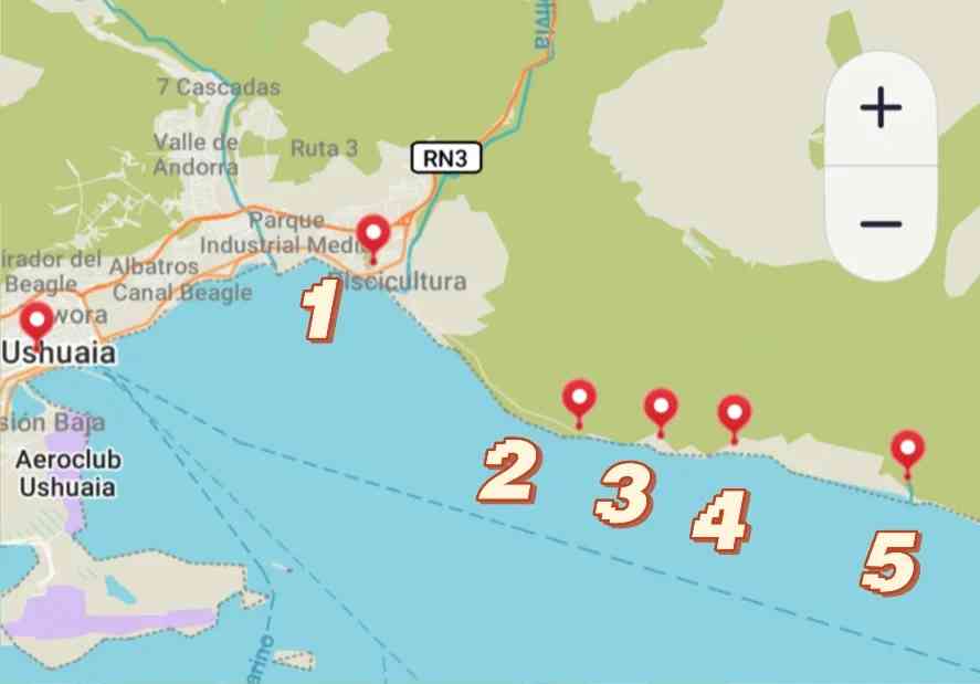
▫️ On page 7, you’ll find the key points along the route: 1) The bus stop; 2) Beacon Tower Baliza Escarpados, marking the end of the road where you can opt for a taxi. The official hiking trail starts downhill from here—just push the gate to open it; 3) A breathtaking viewpoint; 4) An estate, which is private property and off-limits, but follow the signed official route, and you’ll need to climb over a fence later (the official path has a ladder in place); 5) The river mouth, your final destination.
▫️ The scenery is simply stunning, with rivers, the sea, snow-capped mountains, lush forests, and pristine beaches. You can also catch a glimpse of Ushuaia in the distance. The trail is well-marked, and there are numerous QR codes providing information (though signal can be spotty). For restrooms, find a secluded spot to relieve yourself outdoors.
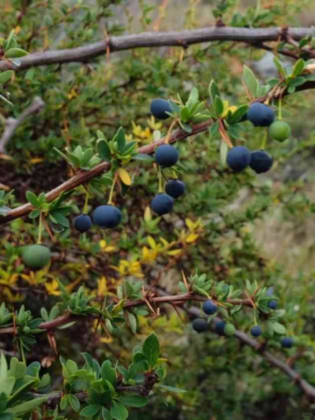
Page 8 showcases the small, edible calafate fruit, which is common in El Calafate.
2️⃣ Mirador camino de L. F. Martial-Las Hayas-Mirador Wallner-Mirador del Martial-Mirador del Beagle-Cascada Nahiara (p10-14, 4km)
▫️ The locations can be pinpointed on Google Maps. The official starting point for this hiking route is Las Hayas Ushuaia Resort. For more details and a route introduction, see page 14 (the official route returns via the same path after reaching Mirador del Beagle).
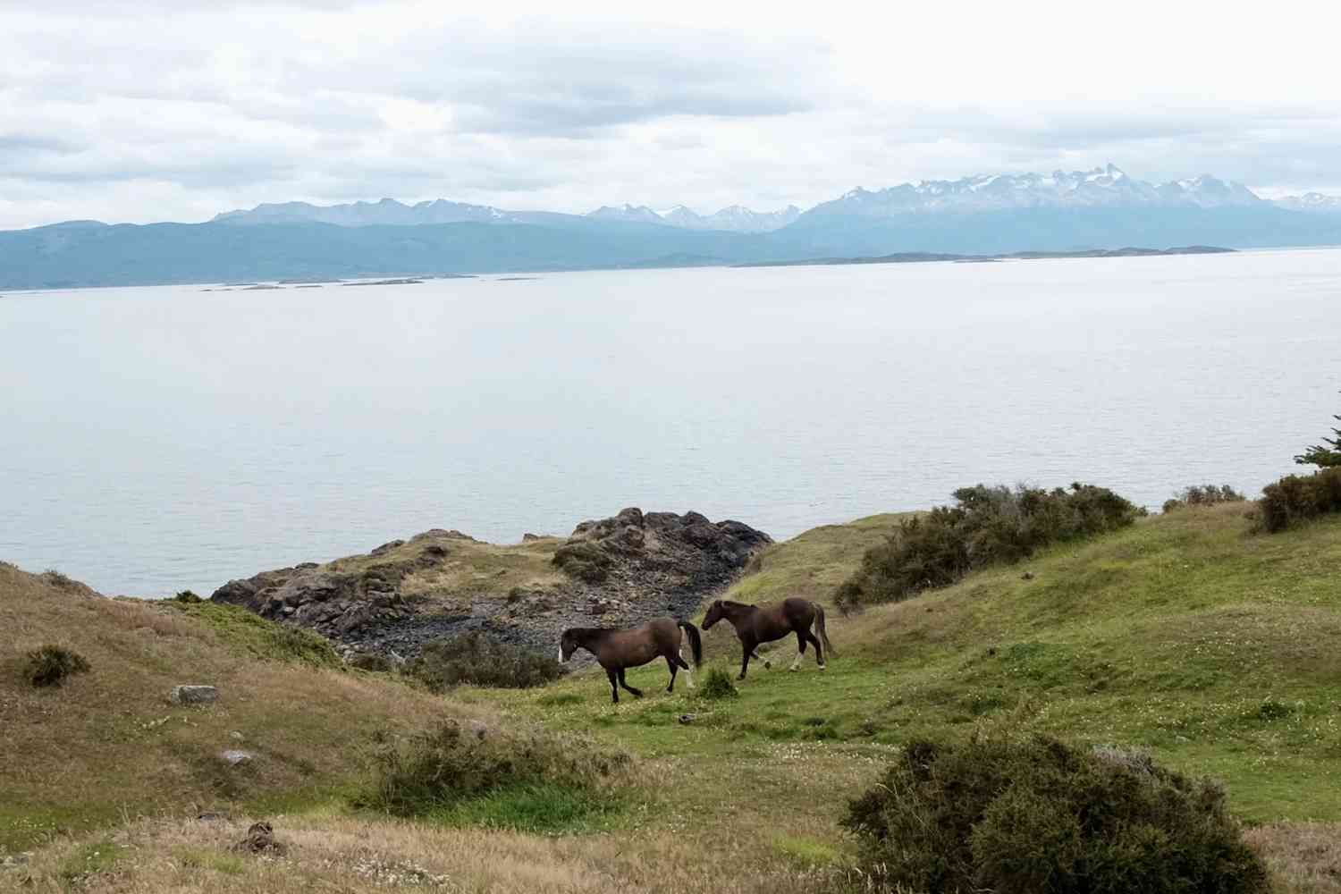
▫️ The views are spectacular, featuring the strait, glaciers, and peat bogs. You’ll pass through a forest that was once worked by prisoners from the old prison, adding a layer of historical intrigue.
▫️ I started my walk from the city center, passing the viewpoint Mirador Maria Auxiliadora, which features a statue of the Virgin Mary and offers a panoramic view of the strait and mountains (see page 9).
From there, I hiked uphill to Las Hayas. The hiking trail begins to the right of the hotel. I got a bit carried away and missed the Mirador del Beagle, following the signs until I reached a fenced gate. Seeing the waterfall Cascada Nahiara ahead on the map, I found a side entrance and continued. It was all downhill from there, and I climbed over the fence to reach the waterfall.
From the waterfall, it’s a scenic walk down to the road, where I found the nearest bus stop to return to the city center.
3️⃣ Airport-city route (p15-18, 6km)
There is a picturesque walking path that many residents use for running. The route passes two iconic Ushuaia landmarks, making it a perfect way to experience the local flavor.
🔸 To top up your SUBE bus card, search for “Conveniencia” on Google Maps. Enter the first small window to handle the transaction. A single trip costs 800 pesos, and you can have an overdraft of 300 or 400 pesos, though the exact amount may vary.
These routes sound amazing! I especially like how accessible they are with the bus system—perfect for solo adventurers like me. Have you tried any of these hikes yourself? I’m curious about the views from Mirador San Sebastian.
Thank you for your enthusiasm! I haven’t personally tried these hikes yet, but I’ve heard incredible things about the views from Mirador San Sebastian—it’s supposed to offer breathtaking panoramas of the city and the Beagle Channel. If you go, don’t forget to bring a camera! Safe travels, and happy hiking!
I’ve always wanted to explore Ushuaia! These routes sound amazing, especially the one with the scenic river canyon. I’d definitely bring a good map app since public transport seems key here. Excited to try it out next time I visit!
These routes sound amazing! I especially like the details about using maps.me to find the starting point—super helpful for solo adventurers. Looking forward to trying the Rio Encajonado hike soon!