Driving on the Southern Highway is an exhilarating adventure, connecting Puerto Montt in the Lake District to Villa O’Higgins in the Aysén Region, spanning a total of 1240 kilometers. The construction of this magnificent route began during the presidencies of Frei and Allende, but progress was painfully slow, with only 3% completed by the end of their terms.
It wasn’t until Pinochet’s era, when he mobilized the Chilean army’s engineering corps, that the highway was finally brought to completion. Interestingly, Patagonia encompasses more than just the well-trodden tourist spots like Chilean Tierra del Fuego, Torres del Paine, and Punta Arenas, as well as Argentina’s Moreno and Fitz Roy; it also includes the lesser-known Aysén Region of Chile.
Thanks to the abundance of national parks along its path, the Southern Highway forms a vital part of the Chilean National Park Route.
When planning my trip, I opted to pick up and return the car in Balmaceda, as returning the vehicle in a different location would be prohibitively expensive, and the back-and-forth journey to Puerto Montt seemed too rushed. My journey began with a drive north to Puyuhuapi and Queulat National Park, before heading south.
Initially, I planned to reach Villa O’Higgins, but later adjusted my route to visit the glaciers, turning back after reaching Cochrane. For me, the constant decision-making and trade-offs during the journey were the most intriguing aspects.
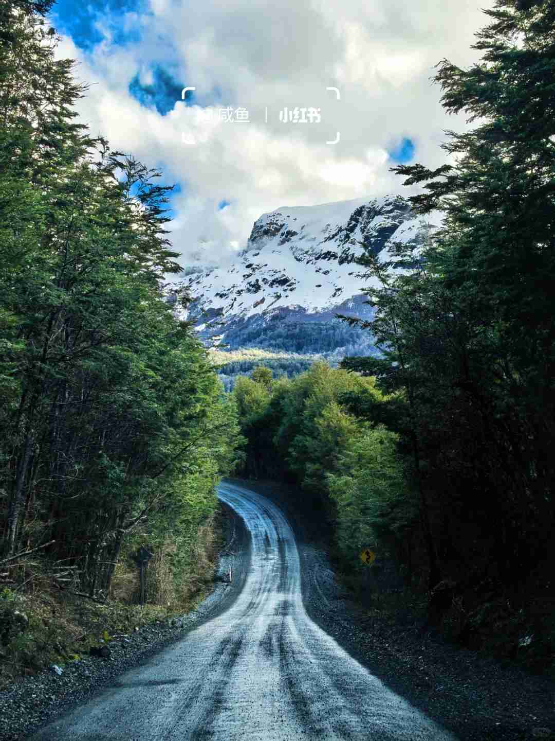
The driving experience on the Southern Highway is nothing short of spectacular, with the route winding through mountains and alongside lakes, offering breathtaking vistas at every turn. After a week, even the most stunning views began to feel a bit monotonous. Large stretches of the road remain unpaved, and passing vehicles often kick up clouds of dust and gravel.
Navigating the front wheels around potholes and puddles, while ensuring the rear wheels don’t slip on the sloping curves, felt like participating in a rally. If I had been on a motorcycle, the experience would have been even more thrilling and romantic. Before setting off, I snapped a photo of the COPEC gas station map to avoid running out of fuel halfway.
To conserve fuel, I often adopted an economical driving strategy, avoiding unnecessary braking and watching the fuel consumption per hundred kilometers decrease. Occasionally, when a local car followed behind, I would step on the gas, driving more aggressively on the mountain roads, only to pull over a few minutes later to let the speeding pickup truck pass.
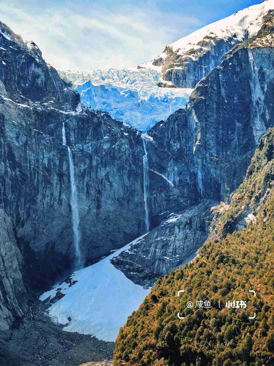
This self-driving adventure took us through five breathtaking national parks. Adding to the previously explored Vicente Perez Rosales and Easter Island National Park, I’ve now visited more of these natural wonders than any U.S. national park. In Queulat National Park, a glacier perched high on the mountaintop transforms into a majestic waterfall, plunging down a nearly vertical cliff face.
At the base, in the shaded areas, the water falls like delicate snowflakes, silently awaiting the warmth of summer.
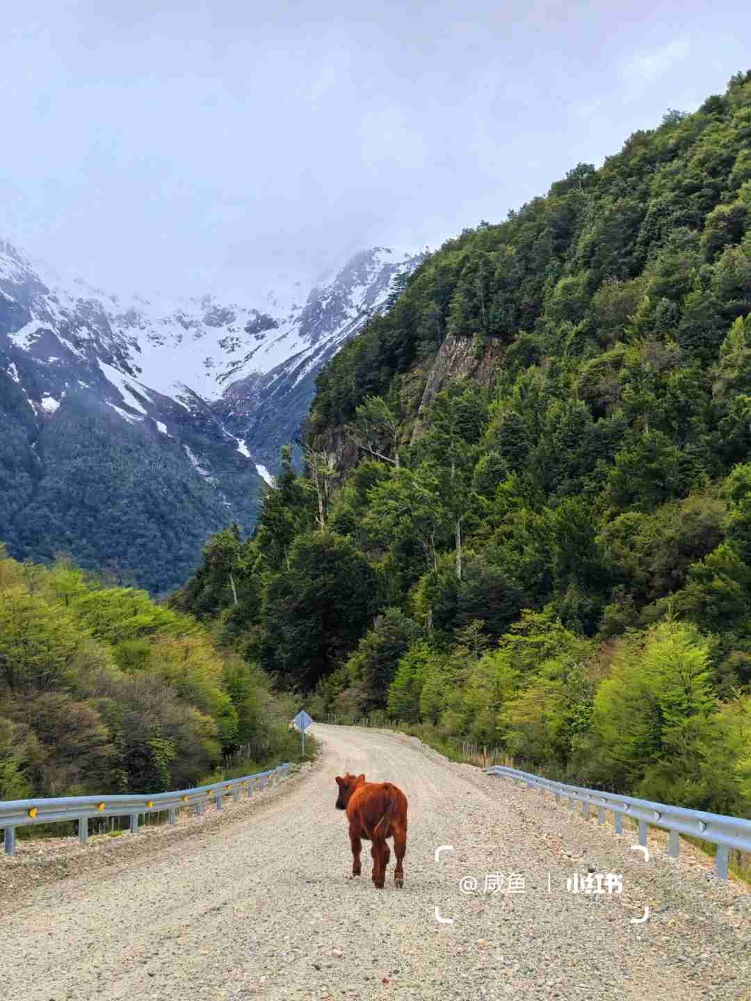
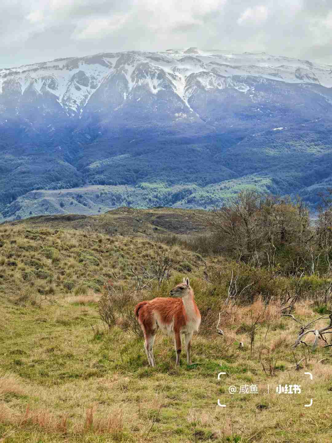
In Patagonia National Park, we cruised along the Chacabuco Valley, all the way to the Argentine border, pausing to let herds of wild guanacos cross the road. The hiking trail in Cerro Castillo National Park was unfortunately closed due to heavy snow at the summit, but the fortress-like peaks were still visible in their full glory from various points along Route 7 and the X-65 link.
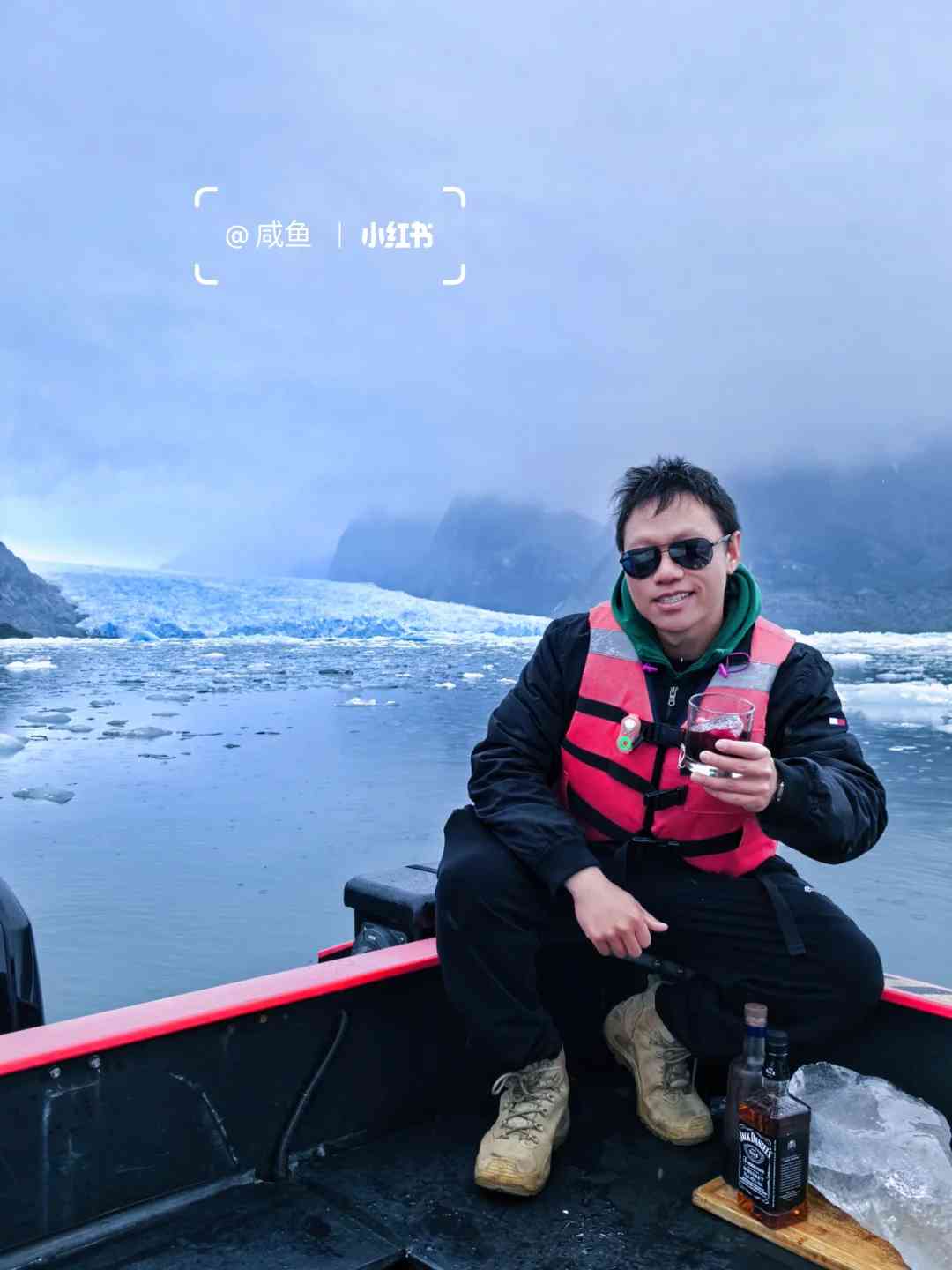
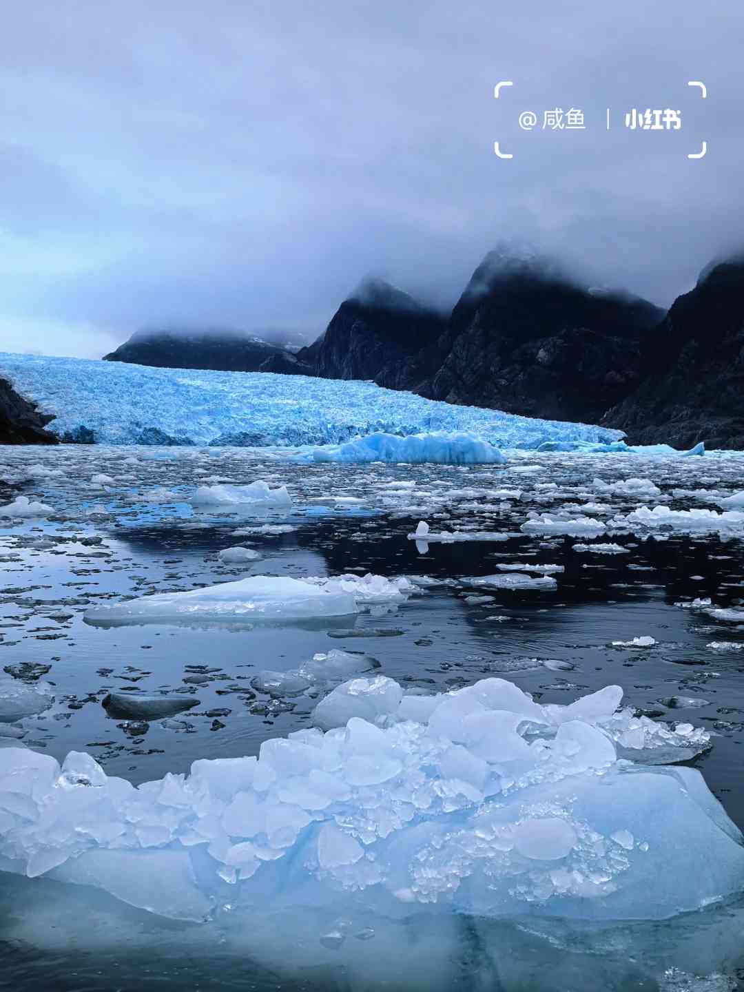
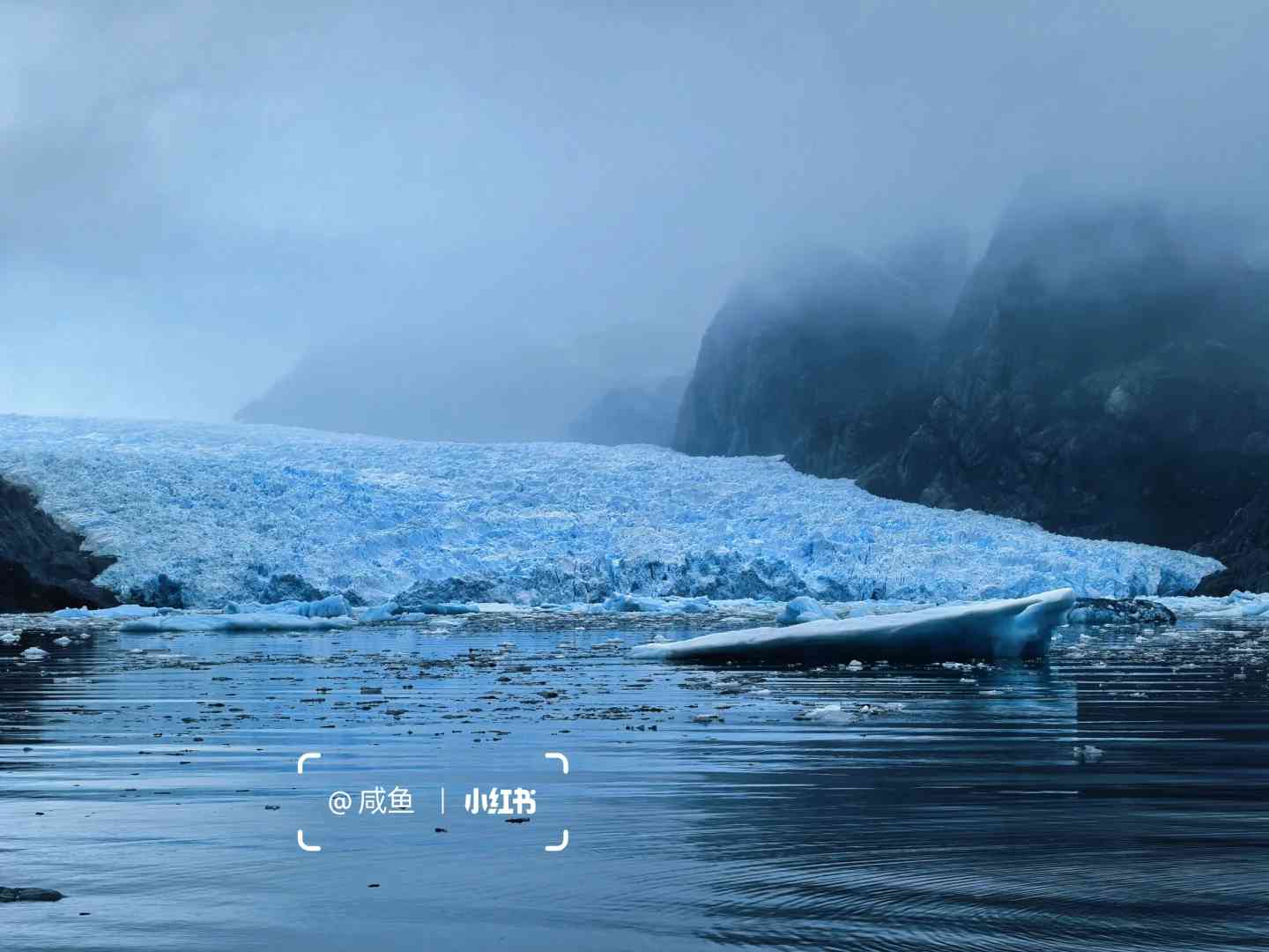
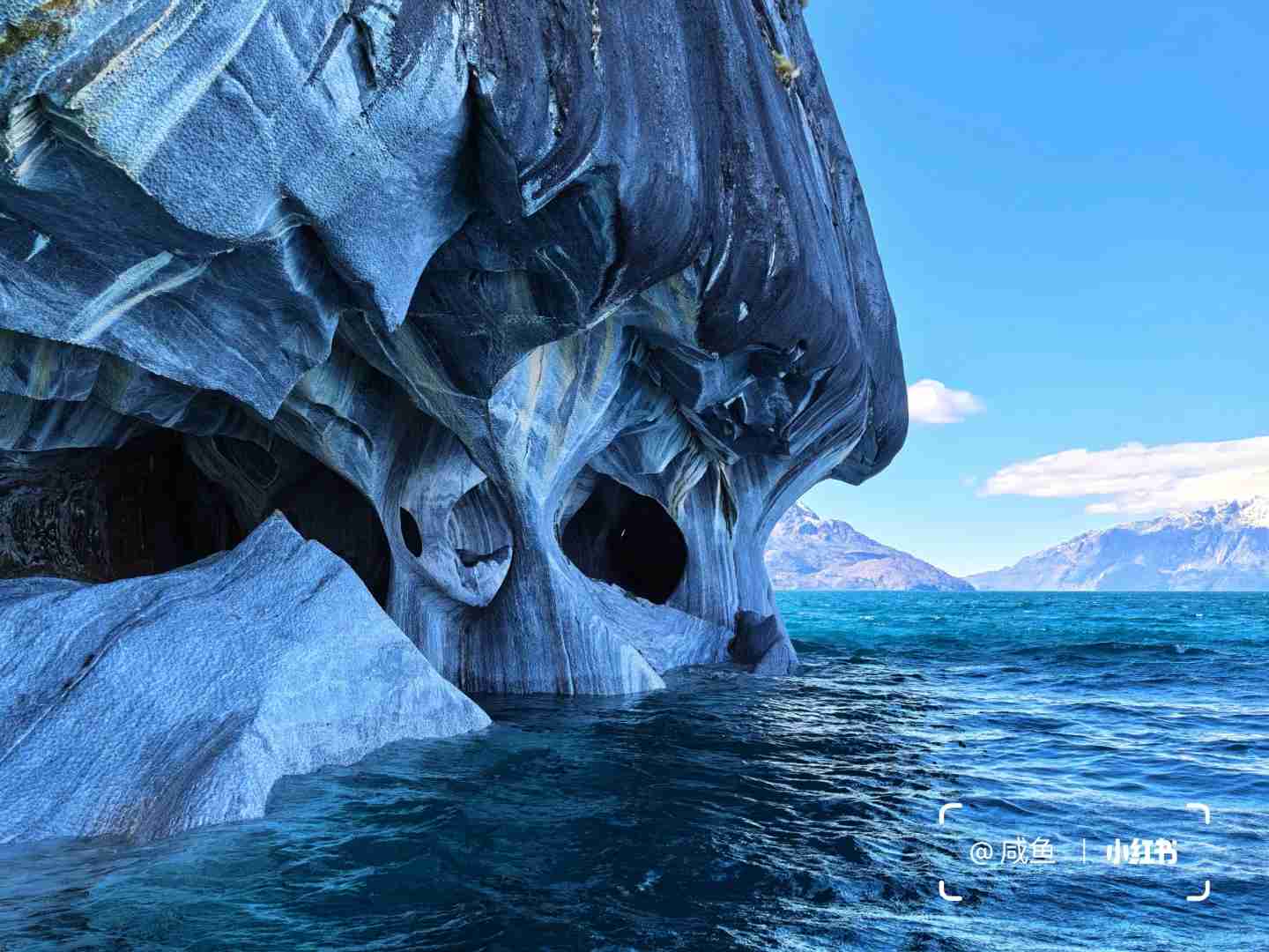
Laguna San Rafael National Park is a part of the northern ice cap in Patagonia. While it is smaller in area compared to the southern ice cap, which includes the famous Grey Glacier in Torres del Paine and the Moreno Glacier, its beauty is no less spectacular. Sadly, it too is quietly enduring the effects of environmental degradation.